This looks good. Maybe even stunning. Vantor has a new way of seeing the planet, and they want you to look at it. They are an American company, earth observation kind. They take pictures from space. But not just flat pictures. 3D. And fast.
The Numbers Game
Ten satellites. That’s the fleet. They hang around looking down, capturing everything with 12-inch resolution. That’s 30 centimeters. On July 1, they dropped the first batch of these shots. You see landmarks. Paris is there, the Eiffel Tower sticks up like it was built yesterday, the Arc de Triamphe, La Défense. It feels like you’re on a plane, wheels down, touching the ground.
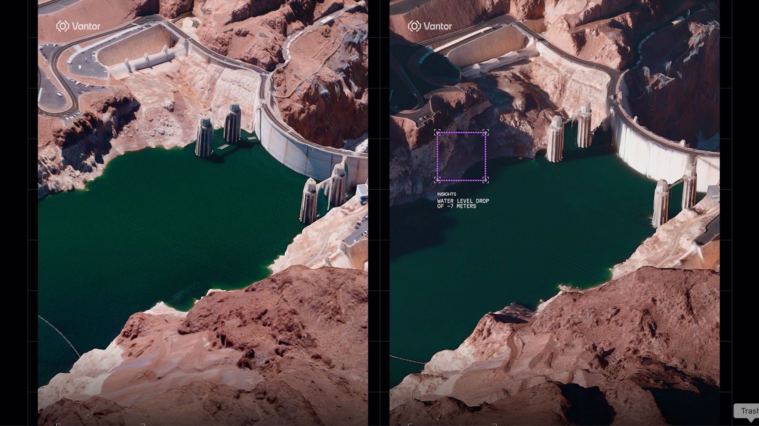
China shows up too. Specifically the Yulin Naval Base. You can watch ships get built, day by day. In Arizona, the water at Hoover Dam is going down. The 3D model doesn’t lie about it.
Two modes for the data. Standard gets you 20-inch resolution, plus or minus 13 feet accuracy in every direction. Go for the HD version and you shrink that down. 6-inch resolution. Ten feet of accuracy in all dimensions. Precise work.
How It Works
They don’t just snap a photo and call it a day. No, they stack them. Images taken from different angles merge together to create depth. The whole map updates every 24 hours. Sometimes faster. If something changes, you’ll see it tomorrow. Maybe sooner.
“From command and control to autonomous systems… many of today’s most complex missionsrequire current, accurate 3d terrain,” said Peter Wilczynski, their chief product officer.
Think about it. Autonomous drones flying around where GPS gets jammed? They need 3D maps that actually match what’s on the ground. Not a map from five years ago. Now.
The Hard Part
Why can’t anyone else do this? They used to rely on airplanes. Or drones. Both expensive. Both slow. You have to book a campaign, send the pilots out, hope the weather is okay. You don’t do that every single day. And let’s be real, you can’t send a plane into airspace controlled by someone who doesn’t like you. It’s risky. Drones are tricky there too.
Satellites? They don’t ask for permission to fly overhead. They just keep spinning, updating, watching. Wilczynski calls it spatial intelligence. He’s not wrong. The scale is unmatched, and the speed? Unheard of for 3D terrain data.
Remote areas? Covered. Contested zones? Still covered. This changes how we navigate the physical world, literally and figuratively. Or maybe it just means we finally stop looking at flat lines.
So here’s the world. Detailed. Updated daily. And slightly unsettling in its clarity. What will you look for first?